Answering the question “which hand held marine GPS should I buy?” this guide highlights five reliable options well-suited for different boaters. The top picks cover rugged floating models, feature-rich navigators for offshore use, and budget-friendly handhelds for casual coastal trips. Best for professional sailors, weekend anglers, or emergency preparedness, these devices prioritize waterproofing, satellite connectivity, and easy-to-read displays on the water. Read on to compare core features and identify the right fit for your needs.
Summary table of selected products:
- Garmin GPSMAP 79sc: Floating, rugged with BlueChart g3 coastal charts.
- Garmin GPSMAP 79s: Worldwide basemap, durable and floating.
- Garmin GPS 73: SAILASSIST features and long battery life for sailing.
- Garmin GPSMAP 86Sci: Floating, in-reach capable, BlueChart G3.
- Garmin eTrex SE: Long battery life, multi-GNSS, sun-readable display.
Garmin GPSMAP 79sc — Rugged Floating Marine GPS
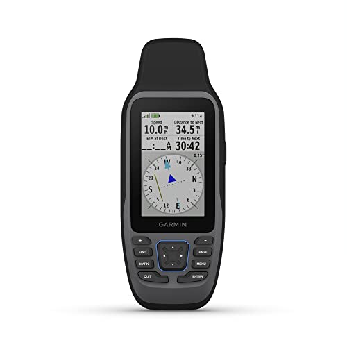
The GPSMAP 79sc is a rugged, floating handheld with IPX6 water resistance and a high-resolution color display. It includes BlueChart coastal charts, enhanced memory for 10,000 waypoints, 250 routes, and 300 activities. It supports multiple satellite constellations for reliable global tracking, making it well suited for offshore excursions and coastal navigation. Best for serious boaters who need a floating backup with extensive chart coverage.
Best for: Offshore skippers and coastal cruisers who require a floating, feature-rich device with reliable global tracking.
Caution: Unit-level water resistance is IPX6; care is needed in heavy spray or submersion conditions beyond rated limits.
Garmin GPSMAP 79s — Worldwide Floating Handheld
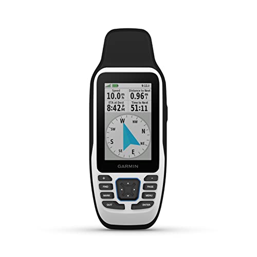
This model emphasizes durability with floating design and IPX6 water resistance. It offers a robust memory expansion to store up to 10,000 waypoints, 250 routes, and 300 activities. Its multi-constellation satellite support ensures dependable navigation around the world. It’s ideal for mariners who travel globally and need a dependable backup with broad charting options.
Best for: Mariners who sail internationally and want a trusted, floating device with ample waypoint and route storage.
Caution: Like other handhelds, screen readability can vary in direct sunlight; consider screen glare considerations for daytime use.
Garmin GPS 73 — Sailor-Friendly Handheld
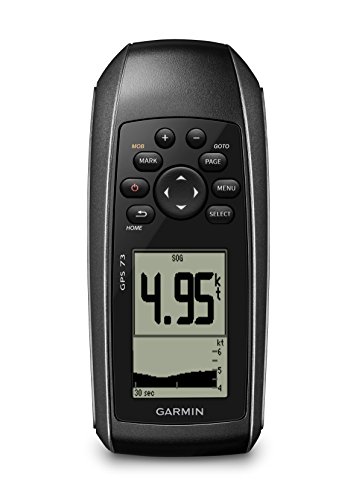
The GPS 73 focuses on sailing features, including virtual starting line, countdown timers, speed history, and tack assist. It runs on long battery life with 18+ hours on two AA batteries and provides marine-oriented alarms and route planning. This device is best for sailboats and racing enthusiasts who want race-ready features in a compact unit.
Best for: Sailors who need race-related timers and marine alarms in a lightweight handheld.
Caution: Battery life depends on AA battery performance; carry spares or a spare battery option for longer trips.
Garmin GPSMAP 86Sci — Floating, Inreach-Enabled

The GPSMAP 86Sci is a floating handheld with a 3” sunlight-visible display and button operation for on-the-water ease. It streams boat data from compatible chartplotters and instruments and comes preloaded with BlueChart G3 coastal charts. It is well suited for boaters who want data integration and reliable coastal mapping in a compact form. Best for: Small- to mid-sized boaters who value data streaming and InReach satellite communication capabilities.
Caution: Button-based operation may take some getting used to for users accustomed to touch interfaces on larger units.
Garmin eTrex 22x — Rugged Multi-GNSS

The eTrex 22x offers a 2.2” sunlight-readable display and preloaded Topo Active maps with routable roads and trails, making it versatile for hiking and coastal exploration alike. Its rugged design and multi-GNSS support improve reliability in challenging environments. Best for: Backcountry explorers who want a compact GPS with detailed topo maps for land and sea adventures.
Caution: Smaller display may limit readability in rough sea spray; consider a model with a larger screen for easier navigation in rough conditions.
Buying Guide: Key Considerations For Your Marine Handheld
- Floating and water resistance: If you boat near waves or spray, prioritize models clearly rated as floating and with IP or MIL-STD water resistance ratings.
- Display readability: Look for sunlight-readable displays and reasonable screen size for quick readings at a glance.
- Chart and map coverage: Decide between preloaded BlueChart/Coastal charts and expandability with memory for waypoints and routes.
- Battery life: Long-lasting operation is essential for all-day trips; check battery type (AA vs built-in) and expected life in typical use.
- Satellite support: Multi-GNSS (GPS, GLONASS, Beidou, Galileo, etc.) improves tracking reliability in challenging conditions.
- Special sailing features: For sailors, consider devices with sailing aids like virtual starting lines, tack assist, and MOB alarms.
- Data integration: InReach or chartplotter data streaming can be valuable for larger vessel systems and remote connectivity.
- Portability vs. capabilities: Higher capability units are typically larger and heavier; choose based on how you plan to carry the device on deck or in the cockpit.
Frequently Asked Questions
- What is the main advantage of a floating marine handheld GPS?
Answer: It remains buoyant if dropped overboard, increasing chances of recovery and reducing loss risk. - Do these devices support marine data like alarms and MOB functions?
Answer: Many do; features vary by model, with some including MOB alarms and marine alarms for off-course or anchor drag events. - Should I choose a unit with BlueChart or Navionics data?
Answer: BlueChart and Navionics provide comprehensive coastal charts; choose based on coverage and ease of use with your preferred software ecosystem. - Is multi-GNSS essential for marine navigation?
Answer: Yes, it improves signal reliability and positional accuracy when satellite visibility is limited. - What’s the trade-off between screen size and battery life?
Answer: Larger screens improve readability but may consume more power; balance readability with expected usage time. - Can I stream data from a handheld GPS to other chartplotters?
Answer: Some models support data streaming to compatible chartplotters or marine instruments, enabling integrated navigation data.