Answer: For dependable handheld and chartplotter navigation, these five picks deliver reliable positioning, durable builds, and comprehensive mapping options. They’re best for coastal skippers, weekend voyagers, anglers, and boaters who rely on accurate charts and easy integration with other marine gear. Below, each product is organized with what it’s best for, key strengths, and a practical caveat to consider.
| Product | Best For | Key Benefit |
|---|---|---|
| Garmin GPSMAP 79sc | Rugged, floating handhelds | Preloaded BlueChart coastal charts |
| Garmin GPSMAP 79s | Worldwide portability | Worldwide basemap, strong memory |
| C-MAP Discover North America Lakes US/Canada | Extensive US/Canada lake coverage | Ultra-wide coverage with vector charts |
| C-MAP Reveal X – US Lakes North East | High-detail lakes and 3D relief | 3D rendered land and Ultra-High-Res Bathymetry |
| Garmin GPSMAP 86i | Integrated comms and data streaming | InReach satellite connectivity with chartplotter data |
Garmin GPSMAP 79sc, Marine Handheld with BlueChart Coastal Charts
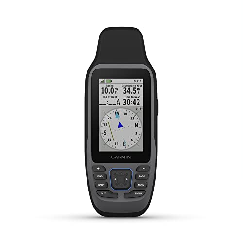
The Garmin GPSMAP 79sc is a rugged, floating handheld GPS designed for saltwater use. It comes preloaded with BlueChart coastal charts and features a high-resolution color display, scratch-resistant glass, and fogproof performance. It supports multiple satellite constellations for reliable tracking worldwide and offers ample memory for waypoints, routes, and activities. Best for boaters who need a buoyant, water-ready device you can take on deck, in fog, or around the marina.
Best for: Anglers and sailors who value a floating, durable handheld with integrated BlueChart navigation. Why selected: The combination of floatation, water resistance, and broad chart coverage makes it a trustworthy coastal companion. Caution: Heavier use in extreme conditions may reduce battery life; carry spare batteries.
Garmin GPSMAP 79s, Marine Handheld with Worldwide Basemap
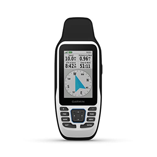
The GPSMAP 79s is a rugged, floating handheld with a bright display, designed for worldwide navigation. It provides an extensive memory to track 10,000 waypoints, 250 routes, and 300 activities, and supports multiple satellite constellations for reliable global tracking. Best for: Mariners who travel internationally and need a dependable, portable chartplotter with broad satellite compatibility. Why selected: It balances durability with ample storage and versatile global reception. Caution: As a handheld device, screen readability may be affected in direct sunlight compared to larger chartplotters.
C-MAP Discover North America Lakes US/Canada Map Card

The C-MAP Discover North America Lakes US/Canada map card offers ultra-wide geographical coverage with fully featured vector charts. It delivers accurate, up-to-date chart detail derived from Hydrographic Office data, plus a high-resolution bathymetry layer to highlight shallow areas and underwater features. Best for: Boaters navigating large freshwater systems in the US and Canada who need detailed lake charts and depth cues. Why selected: Wide coverage paired with precise vector data and bathymetry supports confident inland-water navigation. Caution: This is a map card and requires a compatible device; not a standalone GPS unit.
C-MAP Reveal X – US Lakes North East

The C-MAP Reveal X card emphasizes shaded relief with 3D land and underwater elevation, including Ultra-High-Resolution Bathymetry. It provides full-featured vector charts and compiled Genesis data for richer map detail. Best for: Anglers and divers who want a realistic terrain view and precise depth information in the North East US Lakes. Why selected: The combination of 3D relief, HRB bathymetry, and authoritative charting improves situational awareness. Caution: Data-intensive features may require adequate device memory and processing power.
Garmin GPSMAP 86i, Floating Handheld with InReach

The Garmin GPSMAP 86i combines a floating handheld with InReach satellite communication. It features a robust 3-inch display and supports streaming boat data from compatible chartplotters. Best for: Mariners who need satellite messaging and emergency connectivity while navigating remote waters. Why selected: InReach integration adds reliable two-way messaging and location sharing when cell service is unavailable. Caution: The device is more feature-rich, which may require a learning curve for new users.
Buying Guide: Key Purchase Considerations
- Navigation scope: Choose between handhelds with coastal charts and full cartography map cards for lakes or open water. If you need global coverage, prioritize devices with worldwide basemaps and multi-constellation GPS support.
- Durability and buoyancy: For daily water use, select a floating, weather-resistant unit. Floating models reduce the risk of loss if dropped overboard.
- Chart formats and updates: Vector charts with regular updates provide better route planning and depth information. Ensure compatibility with your chartplotter or handheld.
- Connectivity: InReach or satellite features add messaging and emergency communication. Consider how often you’ll be in remote areas and want connectivity.
- Memory and performance: More waypoints, routes, and bathymetric layers require sufficient memory. Check how many files you plan to store and the device’s processing capacity.
- Screen visibility: High-contrast displays are essential in direct sunlight. Larger screens improve readability of charts and depth data on board.
Frequently Asked Questions
- What is the difference between a handheld GPS and a chartplotter card?
Answer: Handheld devices provide portable navigation with built-in charts, while chartplotter cards add detailed charts to compatible marine plotters at a fixed location on the boat. - Which device is best for freshwater lake navigation?
Answer: Cards like C-MAP Reveal X and C-MAP Discover North America Lakes US/Canada offer high-resolution bathymetry and lake detail ideal for inland navigation. - Do these devices support multiple satellite systems?
Answer: Yes, several listed devices support GPS, GLONASS, Beidou, Galileo, QZSS, and SBAS for reliable positioning. - Is InReach connectivity important for offshore trips?
Answer: InReach adds satellite messaging and tracking, which is valuable for remote voyages with limited cellular coverage. - Can I use these charts on different devices?
Answer: Many chart formats are device-specific; ensure chart compatibility with your existing marine electronics. - Do these products require ongoing subscriptions for updates?
Answer: Some chart products offer updates; check each card’s update policy and your device’s compatibility.